The Bannockburn App
Central Otago · New Zealand — Heart of the Desert
A free, offline-first heritage explorer for Bannockburn — Central Otago's historic gold-mining village and wine country. It brings a whole landscape to life through an interactive 3D map, a curated local directory, a live arts calendar, a native-species guide and an immersive audio-narrated history library.
Free · iPhone & iPad
Works offline in the field
At a glance
A place-based storytelling companion
The Bannockburn App pairs modern technology — a real 3D terrain of the gorge rendered on your device, GPS-driven discovery and high-resolution satellite imagery — with deeply researched local history, so the ground beneath your feet becomes something you can explore, hear and understand.
Free to download
A universal app for iPhone and iPad. No subscription, no account.
Five ways to explore
Home (3D map), Village, Arts, Nature and History.
Works offline
Bundled terrain, satellite tiles, imagery and audio — for patchy coverage.
Made in Bannockburn
Drawing on decades of local heritage research, for the place itself.
Home
The living 3D map
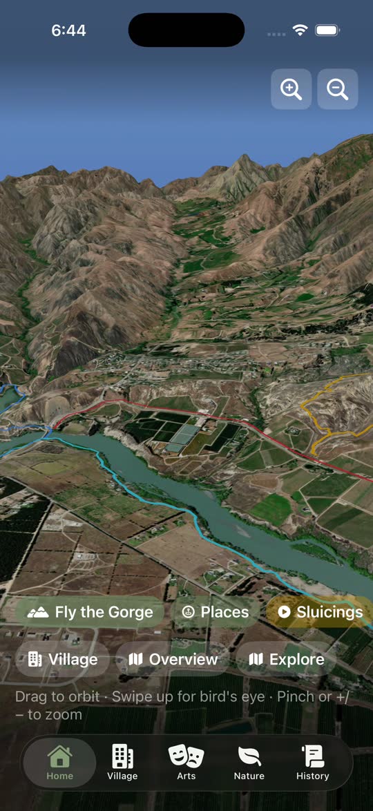
A real, explorable 3D model of the Bannockburn landscape — the gorge, the Carrick Range, the village and Lake Dunstan — rendered live on your device.
Built with Apple's RealityKit engine from real elevation data and draped in a high-resolution satellite mosaic, with dynamic sky and lighting.
Explore it like a globe
Drag to orbit 360° around the landscape; swipe up for a bird's-eye view. Pinch or tap +/– to zoom, from a sweeping overview right down to street level. One-tap snap views jump you to the Village or a full overview.
Fly the gorge
A cinematic auto-flythrough sweeps the camera along the Kawarau Gorge and heritage trails, with narrated captions along the way. Pause or skip at any time.
Discover heritage on the ground
A “Places” layer and a full Explore map surface food, stays, wineries, trails, arts and essentials nearby.
Real sky, real sun
Lighting is driven by the live solar position calculated for Bannockburn's own latitude and longitude. Satellite detail streams in around the camera and is cached to disk for instant, offline reuse.
Travel through time
Step the landscape through five historical eras, watching the land itself shift in colour and character as the story moves. Lake Dunstan only appears in the modern era.
Village
The local directory
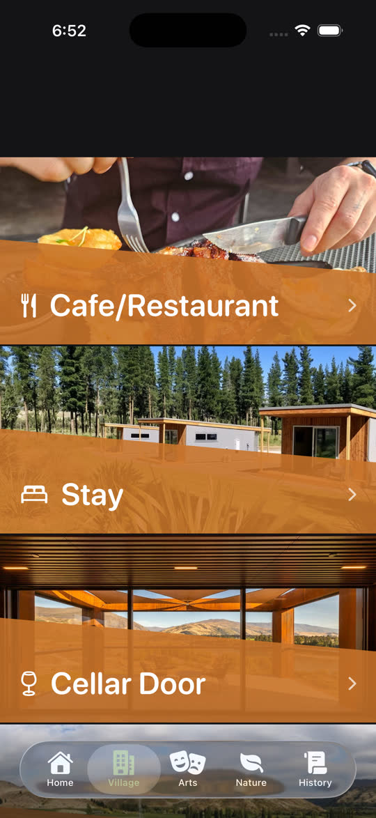
A practical, beautifully presented guide to Bannockburn's businesses: cafés and restaurants, places to stay, cellar doors and wineries, retail, services and community spaces.
Each listing carries a photo, logo, opening hours, contact details and location.
- Browse by category, or see everything at a glance.
- Tap through to book or visit a website in an in-app browser.
- Get turn-by-turn walking or driving directions on an in-app map.
- Includes local wineries such as Carrick, Felton Road and more, plus the Bannockburn Hotel & Bike Hub.
Arts
What's on
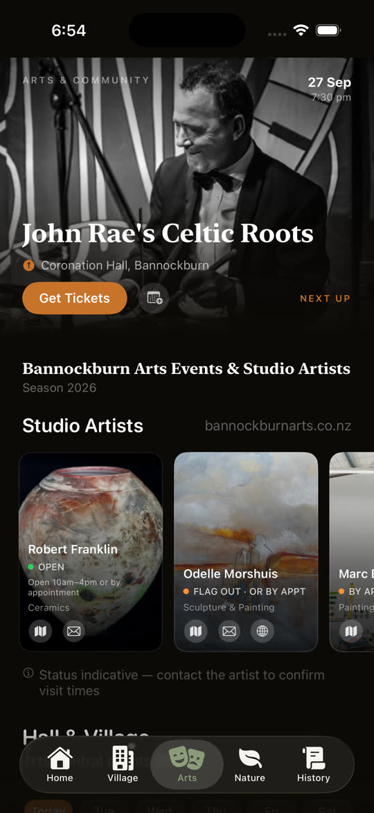
A live calendar of concerts, exhibitions and performances at Coronation Hall, the Bannockburn Hall and nearby venues — alongside profiles of local artists and their studios.
Featured events get their own promoted page, and the whole calendar refreshes over time, so the app stays current.
- A scrollable calendar of upcoming events, with photos, dates, times and venues.
- Buy tickets through an in-app browser, and add events straight to your own calendar.
- Meet local studio artists working in ceramics, painting and sculpture — with studio hours, directions and contact details.
- Highlights such as At the World's Edge's “Unbroken” chamber-music concert are given their own page.
Nature
The species guide
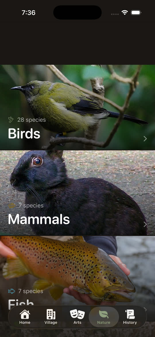
An illustrated guide to the birds, mammals and fish of the Bannockburn basin and Kawarau gorge, with rich photography, natural-history notes and conservation status.
Many entries are accompanied by real recordings of the bird's call.
- Browse by category — 28 birds, 7 mammals and 7 fish — then tap any species for a full-screen photo and profile.
- Listen to authentic bird calls, recorded in the wild.
- English and Māori names, scientific names and conservation status throughout.
History
The audio heritage library
The app's most immersive feature: a series of narrated “books” that tell the story of Bannockburn, set inside a candle-lit 19th-century cottage.
You step through a doorway into the library, choose a book, and settle in as the story is read aloud beside a glowing hearth. Close to an hour of narration in all, and you can leave the cottage whenever you like.
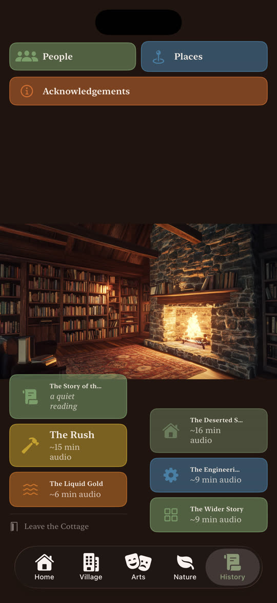
The Rush
How Bannockburn began: gold, the diggers, and the methods they used.
Liquid Gold
The water races, the dams, and the power that drove the sluicing.
The Deserted Settlements
Stewart Town, Quartzville, Carricktown and Shepherds Creek — and four different shapes of leaving.
The Engineering Marvels
The great water wheel at the top of the range.
The Wider Story
Pastoralism, coal and vines: three things the village doesn't tell about itself.
A Central Otago voice
Warm, unhurried narration.
Listen anywhere
Playback continues while your phone is locked or in your pocket — on the track or in the car.
Pick up where you left off
The app remembers your place, so you can come back to a story any time.
About
Made with care, grounded in real history
The Bannockburn App was created by Anna-Maree Morris. Its history content draws on decades of local and academic research — with full acknowledgements to the historians, photographers, archives and community members whose work made it possible.
A new model for regional storytelling: technology in service of real history, anchored to real ground.
Grounded in
- The Bannockburn History Project
- Department of Conservation heritage-landscape studies
- Classic sources on the Otago goldfields
- Local archives, photographers and community knowledge
Download & learn more
Take Bannockburn with you
Available free on the App Store for iPhone and iPad. Download it before you arrive — everything you need works offline, out among the sluicings and the vineyards.